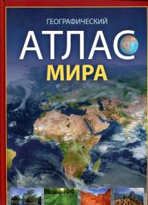
Данное издание содержит комплекс карт, которые являются наглядным пособием для изучения экономической, физической и политической географии нашей планеты и ее отдельных регионов. Атлас состоит из вводного раздела и географической части, которая в свою очередь состоит из еще 10 разделов. В вводный раздел Атласа включены карты звездного неба и сведения о флагах всех государств мира, а также краткие сведения об их политическом устройстве, площади, денежных единицах и официальных языках. Раздел "Карты мира" содержит карты: физическую,тектоническую ,климатические, почвенную, политическую, народы и расы, распространение религий. А также некоторые справочные сведения о Земле. В остальных разделах более подробно рассматриваются отдельные регионы Земли идаются дополнительные диаграммы. При составлении карт Атласа использовались новейшие справочные материалы. Все названия на картах даны в современном написании. Наше издание содержит значительный объем информации и может быть хорошим дополнительным материалом при изучении политического устройства и географической среды Земли.
Dannoe izdanie soderzhit kompleks kart, kotorye yavlyayutsya naglyadnym posobiem dlya izucheniya ekonomicheskoy, fizicheskoy i politicheskoy geografii nashey planety i ee otdelnykh regionov. Atlas sostoit iz vvodnogo razdela i geograficheskoy chasti, kotoraya v svoyu ochered sostoit iz eshche 10 razdelov. V vvodnyy razdel Atlasa vklyucheny karty zvezdnogo neba i svedeniya o flagakh vsekh gosudarstv mira, a takzhe kratkie svedeniya ob ikh politicheskom ustroystve, ploshchadi, denezhnykh edinitsakh i ofitsialnykh yazykakh. Razdel "Karty mira" soderzhit karty: fizicheskuyu,tektonicheskuyu ,klimaticheskie, pochvennuyu, politicheskuyu, narody i rasy, rasprostranenie religiy. A takzhe nekotorye spravochnye svedeniya o Zemle. V ostalnykh razdelakh bolee podrobno rassmatrivayutsya otdelnye regiony Zemli idayutsya dopolnitelnye diagrammy. Pri sostavlenii kart Atlasa ispolzovalis noveyshie spravochnye materialy. Vse nazvaniya na kartakh dany v sovremennom napisanii. Nashe izdanie soderzhit znachitelnyy obem informatsii i mozhet byt khoroshim dopolnitelnym materialom pri izuchenii politicheskogo ustroystva i geograficheskoy sredy Zemli.
This edition contains a set of cards that are a visual aid for the study of economic, physical and political geography of our planet and its separate regions. The Atlas consists of an introductory section and geographical part, which in turn still consists of 10 sections. In the introductory section of the Atlas included maps of the sky and information about flags of all countries in the world, as well as brief information about their political system, areas, currencies and official languages. The category of "world Maps" contains maps: physical,tectonic ,climatic, soil, political, peoples and races, the spread of religions. As well as some reference information about the Earth. In the remaining sections set out in more detail particular regions of the Earth ydautsya additional charts. In compiling the maps in the Atlas use the latest reference materials. All the maps found in modern writing. Our edition contains a significant amount of information and can be a good supplementary material for the study of political structure and geographical environment of the Earth.

